Biography
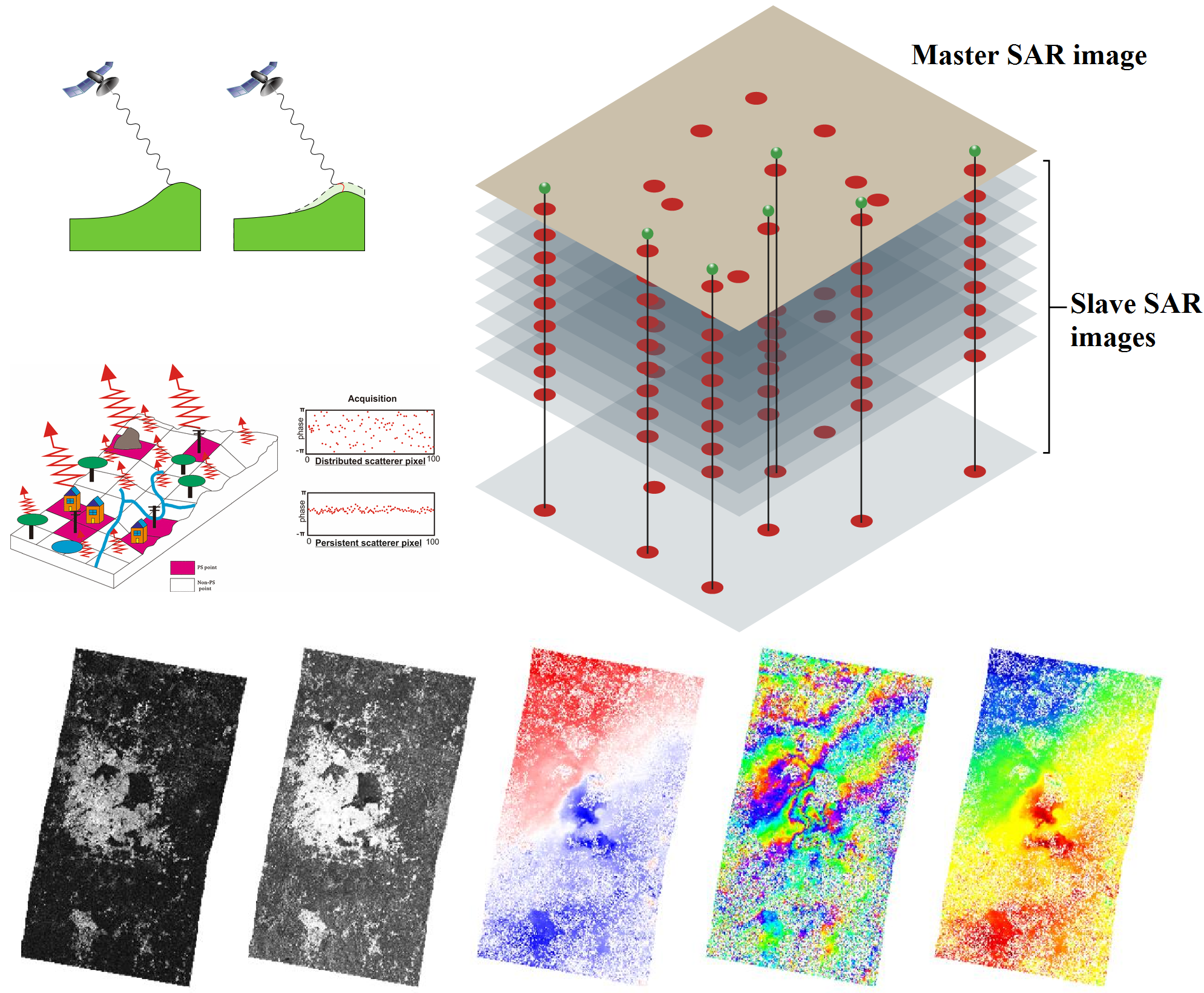
Siavash Shami has been completed his Master’s Degree (M.Sc.) in Geodesy, Faculty of Geodesy and Geomatics Engineering at K. N. Toosi University of Technology in 2018. His research concentrates on the areas of Geodesy (Crustal Deformation), Remote Sensing, and Earth Sciences phenomena. He employs Geodetic methodologies, including InSAR and GPS, alongside Geological and Hydrological data, to investigate Natural Hazards. Furthermore, Siavash integrates advanced techniques such as Machine Learning, and Deep Learning to enhance his analysis and understanding of these phenomena. Additionally, he addresses various aspects of InSAR Errors, such as Phase Bias, Interferogram Networks, Reference Point, Atmospheric Delay, and Multi-Looking techniques, to enhance the accuracy and reliability of InSAR analyses. Siavash further conducts research on applications of Remote Sensing, encompassing areas such as Soil Moisture, Water Storage, GroundWater, Precipitation, Air Pollution, Land Use and Land Cover Change, Soil Erosion, Climate Change, Drought, Flood, and Agriculture. He began his academic activities in 2018 and has since published 7 papers in 5 reputable publishers (Elsevier, Nature, IEEE, Taylor & Francis, and MDPI). These papers have appeared in 6 journals indexed in Web of Science (WoS). Additionally, he has undertaken the review of 7 scientific manuscripts (from 5 journals of 3 publishers indexed in WoS).
Research Interests
Main Research Topics: Geodesy, Remote Sensing, Earth Sciences, Natural Hazards, InSAR Erorrs
Research Tools: InSAR, GPS, Google Earth Engine, Machine Learning, Deep Learning
Research Data: Remote Sensing, Geological, Hydrological data
Website Last Update: June 30, 2026